HERE, a location data and technology platform, has unveiled HERE Geodata Models to help accelerate the telecommunications industry’s planning and deployment of 5G wireless networks while reducing network planning operational expenses.
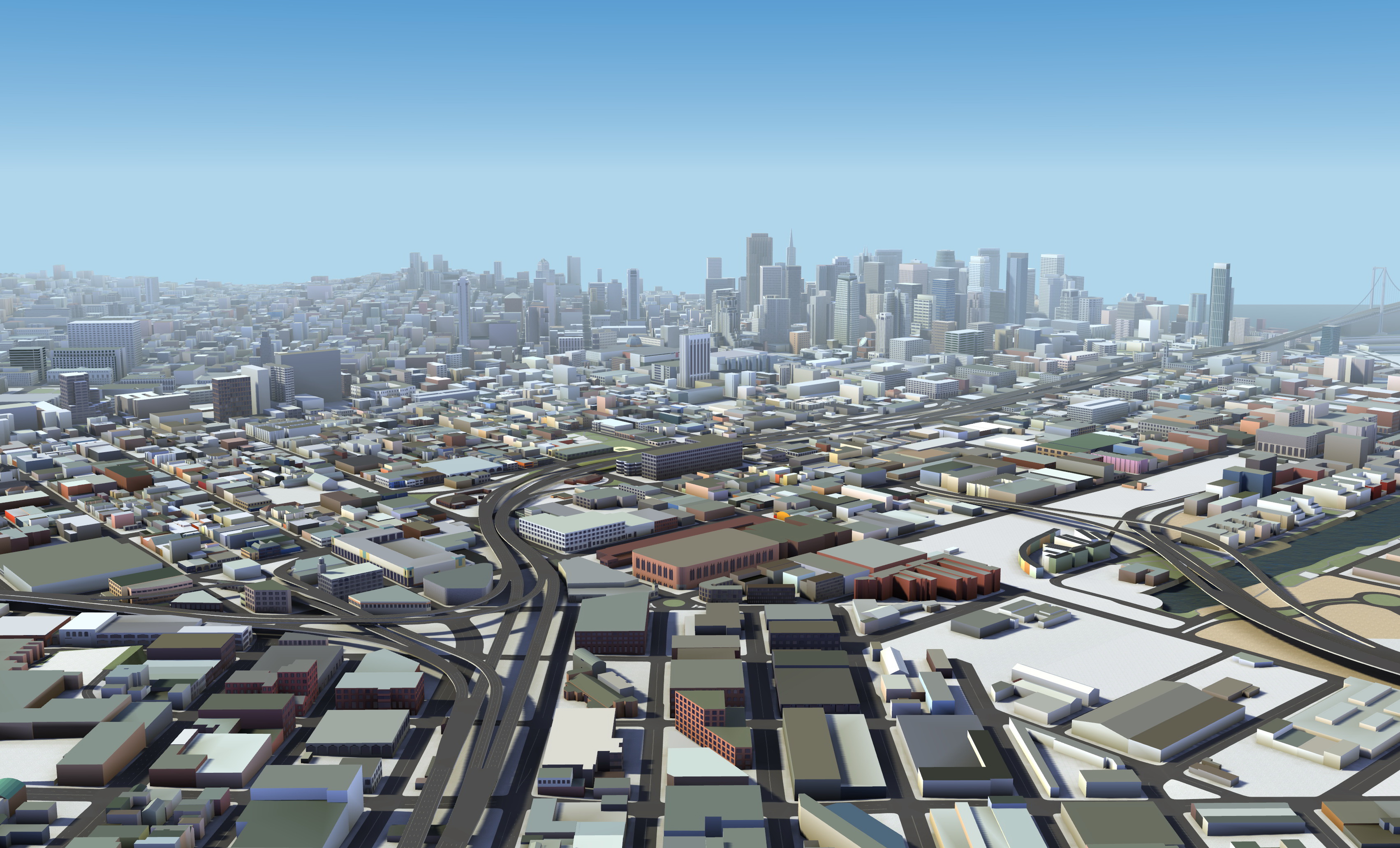
HERE Geodata Models is described by the company as a precise and scalable 3D digital representation of the buildings, trees and roadside objects (such as streetlights, utility poles, overpasses, billboards, etc.) making up the physical environment surrounding 5G antennas. The 3D digital representations provide 5G network planners and radio frequency (RF) engineers with the ability to remotely conduct field surveys and precisely plan where to locate 5G antennas in order to create optimal signal coverage.
The physical characteristics of mmWave 5G networks may require operators to install up to 10 times as many cell sites per km2 compared to 4G networks. Unlike midband spectrum 4G networks, 5G signal paths within mmWave spectrum bands are especially vulnerable to obstruction from ground level objects such as buildings, trees and billboards. In order to adapt to this mmWave spectrum band behavior, network operators require a much higher level of location precision and scalability that is often not supported in legacy 3 and 4G network planning and design solutions.
HERE is partnering with multiple industry, including Nokia and Kinetica, to integrate this 3D data into their network planning and design solutions. By doing so, network operators can conduct centralised, digital field surveys to accelerate network deployments and reduce overall design and network planning related operating costs.
“It’s an exciting time for the telecom industry, with the focus on delivering outstanding network services today while investing in 5G and advanced network capabilities that are powering the future of consumer and business IoT,” says Giovanni Lanfranchi, chief technology officer at HERE Technologies. “HERE Geodata Models provides the detail mobile network operators need to accelerate the design, deployment and benefit of 5G networks worldwide.”
HERE Geodata Models for 5G network planning include:
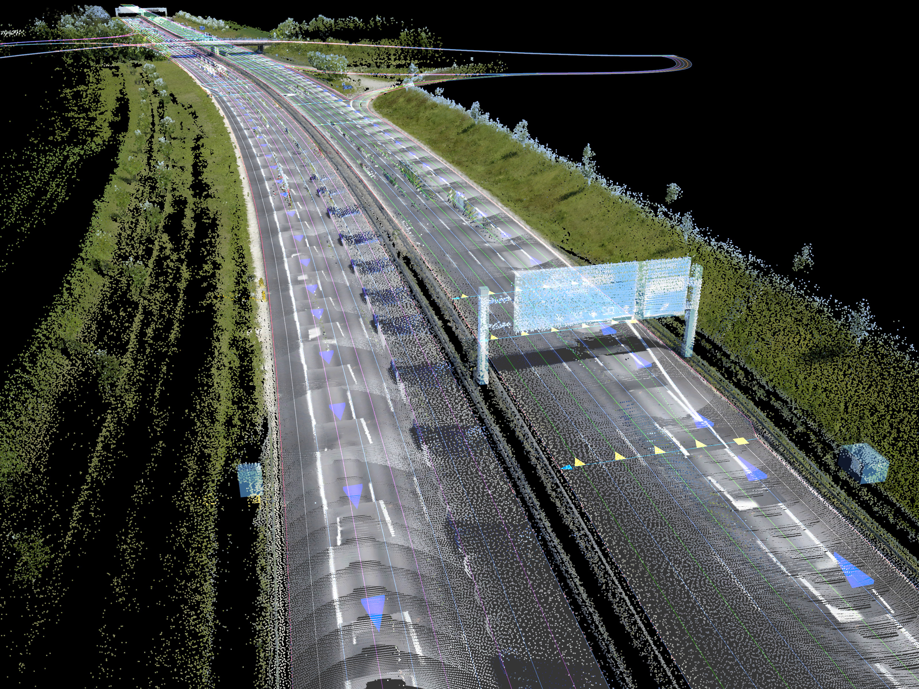
- 3D representations of building volumes with precision of ± 1 metre or better for the building centroid location and building geometry, including building heights;
- 3D cylindrical representations of individual tree trunks with geospatial and geometric precision of ±1 metre or better;
- 3D volume representations of tree foliage/vegetation with geospatial and geometric precision of ±1 metre or better;
- 3D cylindrical representations of the vertical components of individual utility poles with geospatial and geometric precision of ±1 metre or better;
- 3D cylindrical representations of the vertical components of individual streetlights with geospatial and geometric precision of ±1 metre or better; and
- Digital Terrain Models (height maps of the bare earth) with resolution levels of 1 metre or better.
Measuring cellular signal strength and coverage across all networks
The transition from 3 to 4 to 5G is not binary, and mobile network operators want to utilise the full RF spectrum to optimise service. As operators maintain multiple networks and prepare for the 5G IoT demand, the HERE Cellular Signals product can help by providing information about mobile network performance across 196 countries. Operators can get a detailed snapshot of their own mobile network coverage as well as that of competitors. Signal strength is represented for each cell tower in a polygonal configuration and measured in 4 categories: Excellent/Good/Fair/Poor.
HERE Cellular Signals helps cellular carriers monitor the performance of their own network, conduct competitive analyses to identify areas of relative strength and weakness while making more informed network planning decisions.
3D location data for 5G innovation in telecoms and beyond
HERE Geodata Models joins the company’s portfolio of high definition and 3D mapping solutions for enterprise use cases. Automated vehicle systems (SAE L1-5) utilise HERE Lanes and HERE HD Live Map for improved safety and comfort, while Verizon and HERE are bringing together the 5G network, edge computing and the HERE HD Live Map in an effort to develop vehicle and pedestrian collision avoidance technology. The solution is being tested for large scale traffic simulation, better location identification and navigation for last mile delivery and ridesharing pick-up/drop-off, and real-world video game development.
HERE uses artificial intelligence (AI) and machine learning (ML) to continually improve and deepen Geodata Models by automatically detecting, capturing and classifying derivative 3D objects such as poles, tree trunks, tree canopies and buildings at scale.
Comment on this article below or via Twitter: @VanillaPlus OR @jcvplus